Meet us at Overland Rally June 20-23. If you are looking for an overlanding camper that is super durable, light and great for winter camping this is what you want. We will sell just camper or include the truck. We will also deliver if you cover gas costs (we’ll keep receipts). Truck & Camper details below. Priced to sell a new camper with all our accessories would cost $50K, New Tacoma (can’t get V6 anymore) $55K.
$69K for both or $29K for Camper Only OBO-2021 Camp M Overland Explorer in mint condition-well taken care of when not in use parked in garage or under carport-winterized. Here’s why we love this combination:
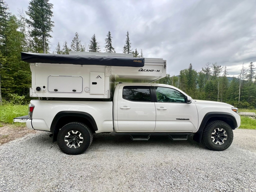
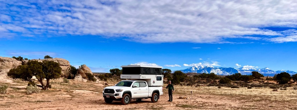
- Durability: The Tacoma Off Road variant is a rugged companion, built for off-road adventures. Its narrow body allows us to explore even the most challenging terrain. The Camp-M is made from extruded aluminum, the interior is clean and tough.
- Comfort: The Tacoma’s interior is surprisingly comfortable, making long drives enjoyable. Plus, the quiet cabin ensures a peaceful journey. The Camp-M
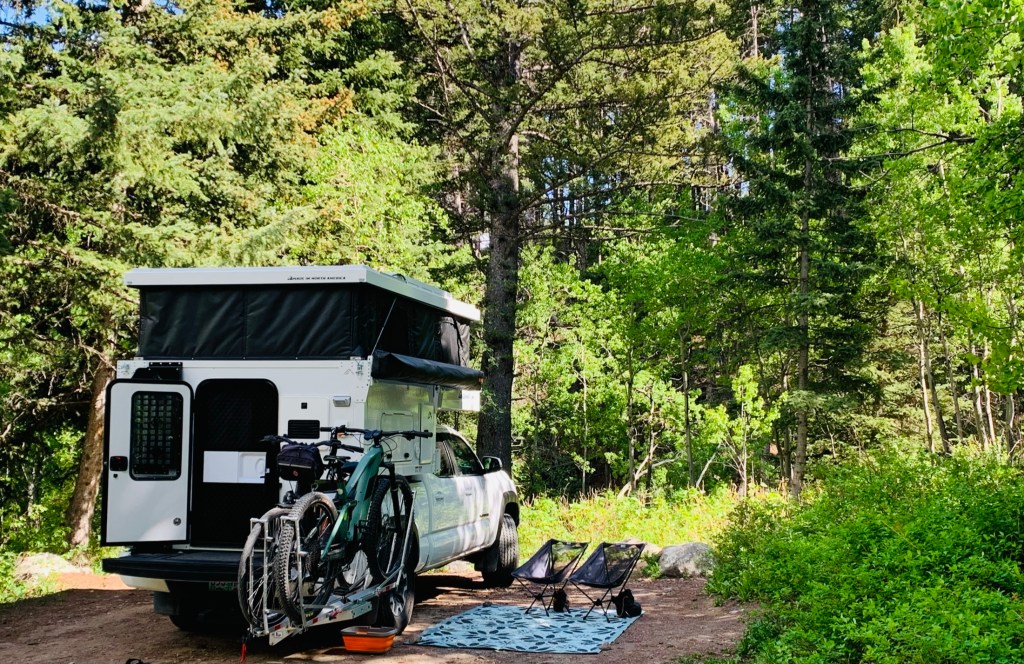
- Off-Grid Capabilities: The Camp-M is designed for off-grid living. With its composite construction (extruded in one piece to prevent leaks), we can confidently camp in remote locations.
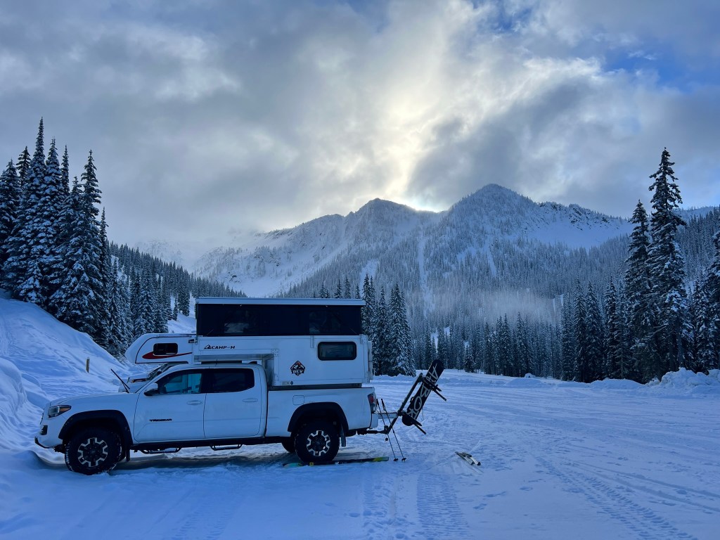
- Winter Camping: Thanks to the Camp-M’s insulation and thoughtful design, winter camping is a breeze. No more shivering nights!
If you’ve never heard of OEV, they’re a branch of LITE Industries Inc., from Alberta, Canada, with a knack for turning any old pickup truck into a mobile home suitable for off-grid travels and life. The campers they produce are completed from composites, extruded in one piece to ensure no leaks and tailored to fit mid-size beds from 5 feet (1.53 meters) to 6 feet (1.83 meters) in length.
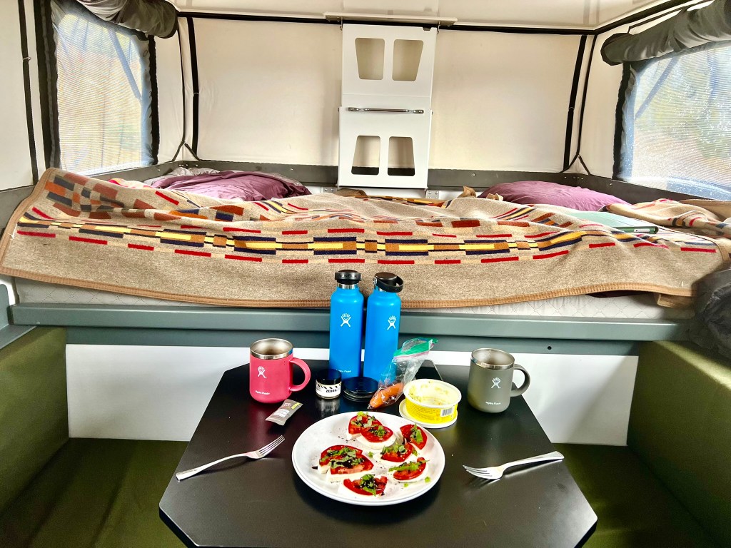
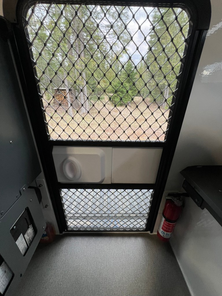
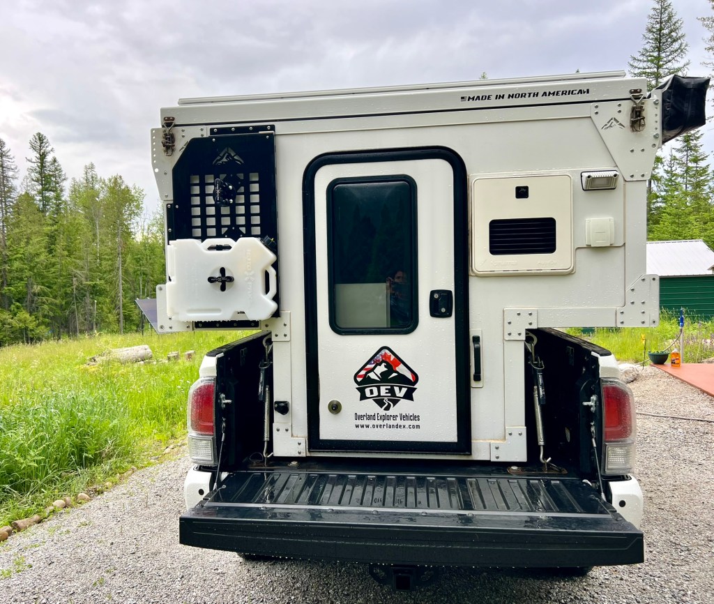
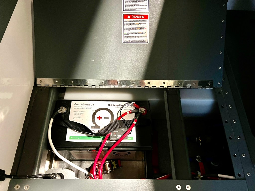
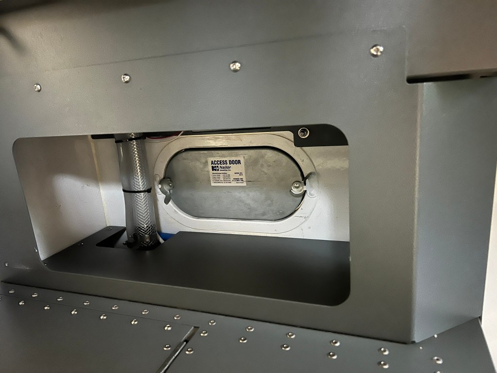
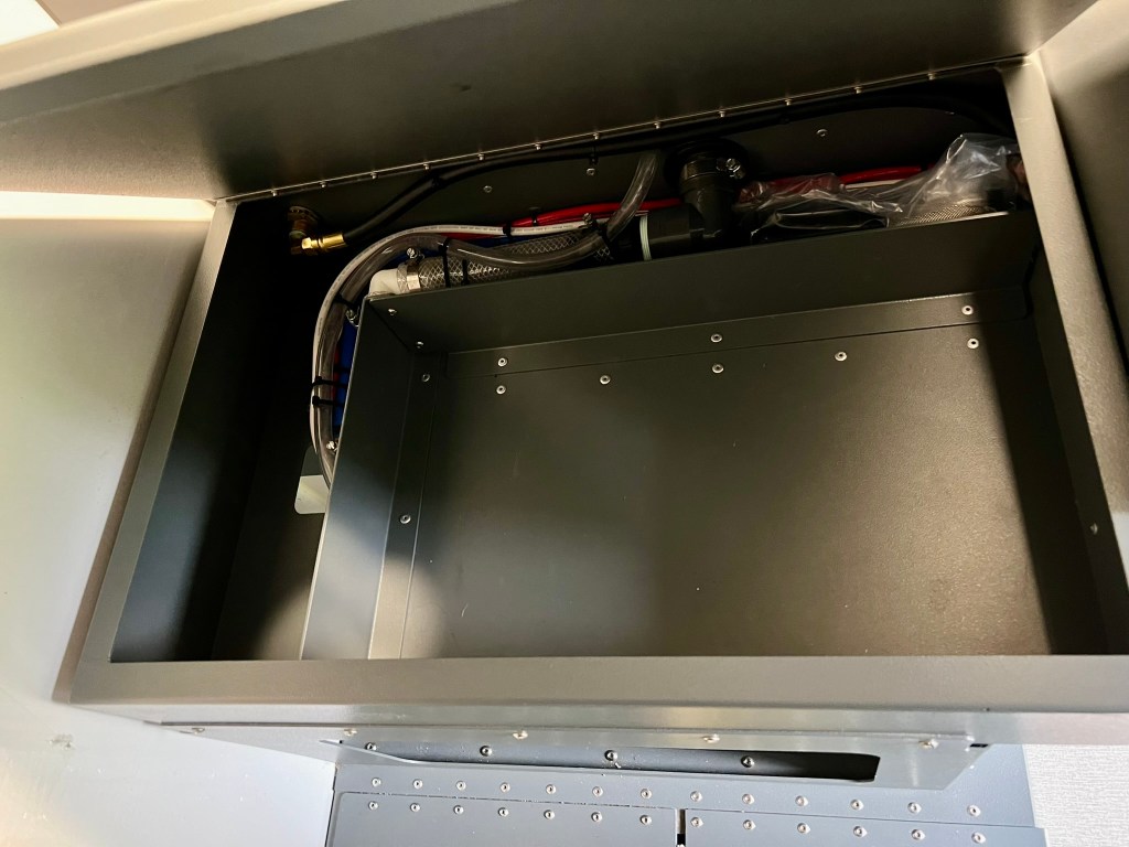
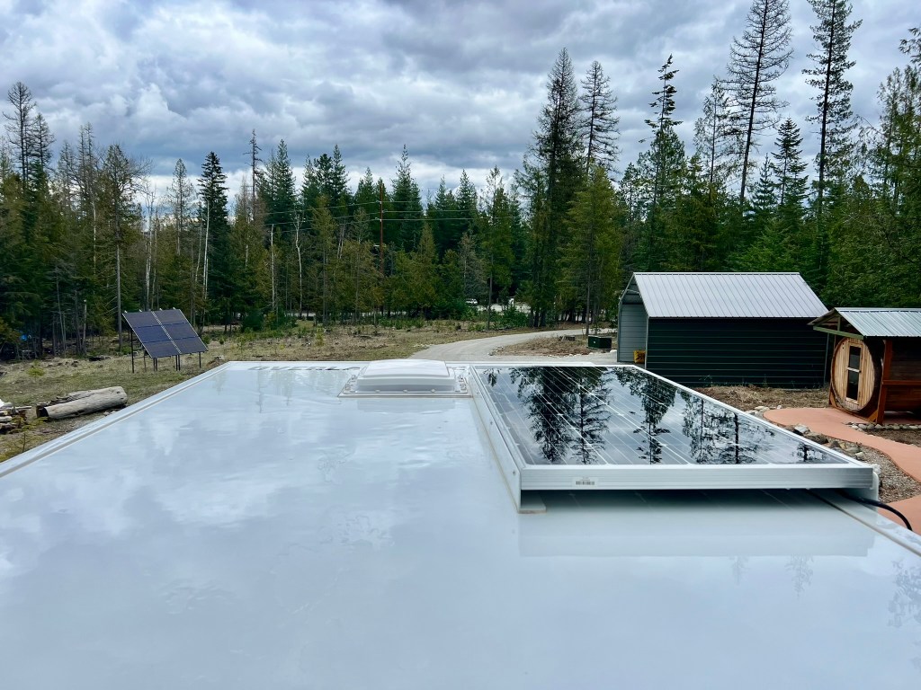
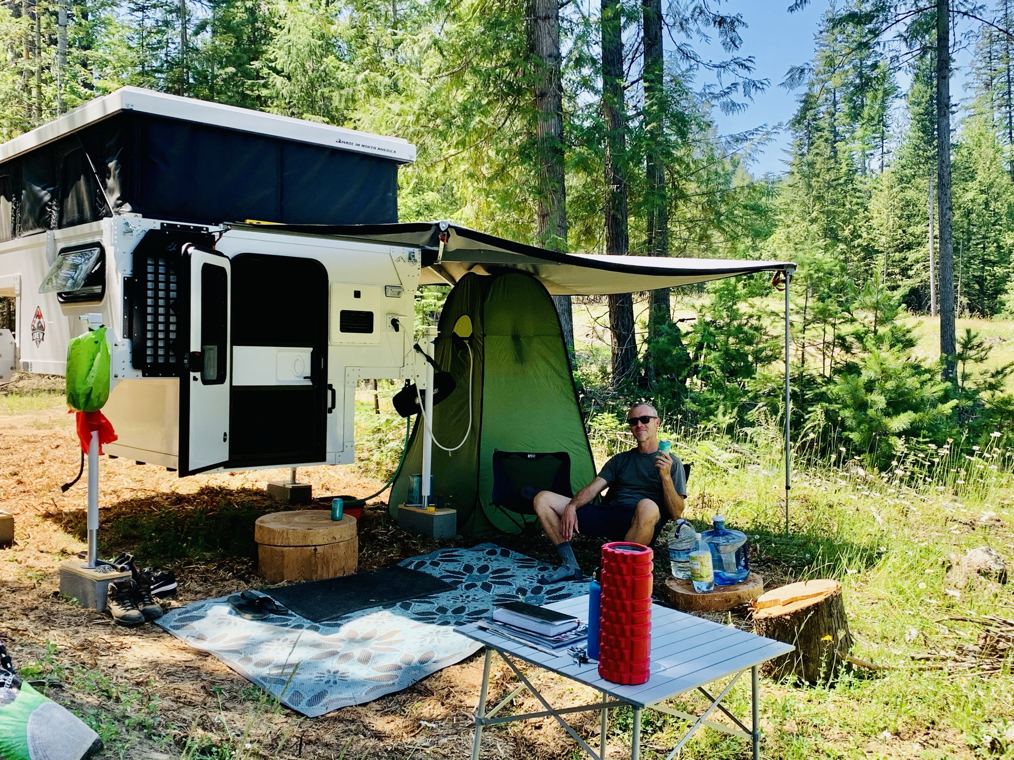
The Camp-M is great off the grid and has features to make your off the grid experience more comfortable including (this is a mix of what is included and options we selected: a Truma Vario w/thermostat and AquaGo instant water heater, multi-speed MAXXfan roof vent, 20-gallon (91-liter) freshwater tank, and interior propane connection for a portable cooktop. A beefed-up electrical system is also in place and features everything from dual USB ports, a 12-volt auxiliary connection, a Redarc charger, lithium battery and 200 W solar panels. The screen door is a wonderful feature to keep the bugs out but get better cross ventilation and fresh air on those hot summer days and nights! It has a 10-pound propane tank for your heater and cooking needs. We loved the outside instant hot water shower and found standing on your tailgate to shower made it easy and kept your feet clean! Compared to many campers the electrical and plumbing are clean and organized and easy to follow. The extruded aluminum construction makes it very durable, lightweight and long lasting with no wood to fail. The composite panels have the same automotive gel coat finish as a fiberglass boat or Corvette. The aluminum extrusions are powder-coated white. If you are in a good sunny spot and near a stream for additional water, we were able to boondock a week when we were in Red Lodge, MT.
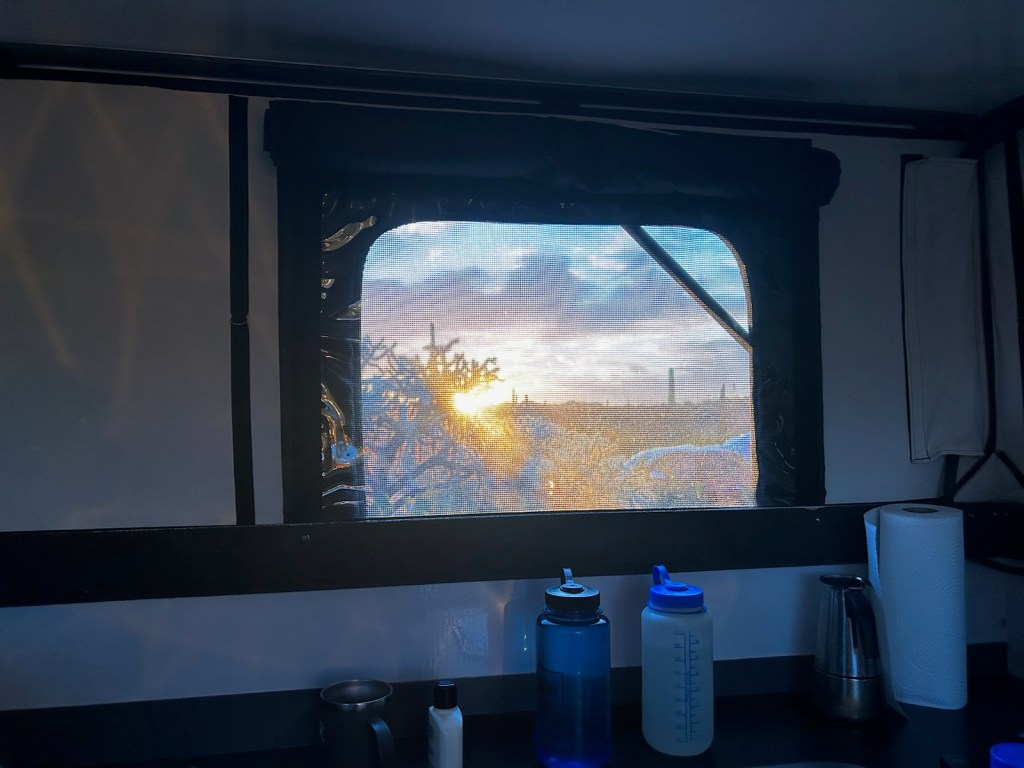
We like to do a lot of winter camping as we go searching for the powder skiing. The soft walls are rated R-4, made from a coated nylon on the exterior, a thermal fill for insulation, and a fire-rated canvas on the interior. The nylon they chose has the highest UV rating on any exterior-purposed nylon product on the market. The exterior nylon is dark grey for the highest UV block. The interior canvas is light cream to brighten up the interior. The sidewalls are designed to breathe. That prevents the sidewalls from retaining moisture. With the heater going all night and you breathing we found there was a lot of condensation, we crack the side window to help with that.
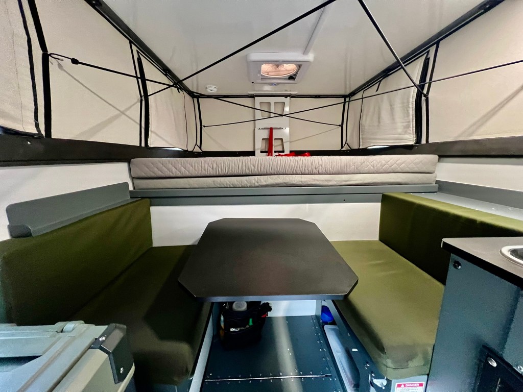
Inside the Camp M, sitting above the cab, you’ll find the bedroom with a 4″ memory foam queen mattress with an extender and additional memory foam to make it a King bedding suitable for two guests plus a four-legged friend or small child, I fit snuggly at 5’3″. A dinette sits at the foot of the bed. This dinette can also be converted into a sleeping area ideal for another smaller occupant and has storage under the seats. The cushions are made from marine grade fabric that is 4” medium-density foam. At the entrance of Camp M, you’ll find the kitchenette with a countertop, sink, faucet, gas connector for your stove, more storage and the tray for your cooler style refrigerator. We purchased the dependable, efficient Truma C63. The vinyl flooring is pretty indestructible, easy to clean and functional. The dimmable LED lights are one of our favorite features, especially as you wake up in the morning and don’t want to get blasted with a bright light right off the bat.
Dimensions: Exterior: 122″L x 77″W x 61″H closed, 83″H open Dimensions Interior: 118″L x 72.75″W x 81″H open Dry Weight: 975 pounds
Features:
-Cold weather package
-includes 10 rubber feet protect camper and truck bed 4
torque lift tie down latches
-powder coated
aluminum extrusions
-OVE generation 4 composite floor
-Walls and roof R8
-Insulated soft walls R4
-locking roof supports
-gas struts assist for lift -DOT LED Lights
-Truma CP and Vario heat w/thermostat
-Truma AquaGo LP Gas instant water heater
-continuous hot
water with sigiva outside shower connection and hose extension
-Truma C63 refrigerator
-10 speed Maxxfan roof vent
-20 gallon fresh water tank w/12v Flow Max Fluid Pump
-s/s sink w/flush mount glass top
-propane connection for portable cooktop
-entrance door grab handle
-screen door
-aluminum propane cabinet w/10lb bottle
-front east/west dinette folds down into a small bed
(28’x63.25″) w/under seat storage
-flip up countertop
-large exterior storage access via locking cargo door
-marine canvas cushions
-4.5″ medium density foam cushions -King Bed
extension
-high traffic grade Lonseal vinyl flooring
-fire rated thermal break kit and fire extinguisher
-structural powder coated aluminum interior cabinet
cabinetry
-LP/Smoke and CO detectors
-Dual USB Plug -12v auxiliary connection
-LED entry Light
-LED interior lights (dimmable)
-LED exterior lights
-REDARC BC/DC 1240 charger
-Dual Pane acrylic side window
-RIECON Titan 4 corner camper jacks heavy duty 2000 lb per jack capacity full 36″ lift
-180W solar panel
-OHMMU Gen 3 Group 31 Premium Lithium Battery 156 Amp hours 2000Wh built in BMS
-Canada Proof Battery Monitor
-Alucab 270 shadow awning (length 2.6m, weight 24 kg, shade area 10m2, aluminum construction, RHS mount, material is acrylic impregnated, with a heat reflection silver coating on one side. Has additional
water repellent coating on surface side, built in fungal resistance to prevent mold, water penetration/water column capability greater than 1000mm/1m -powder coated aluminum awning adapters
-OVE Molly rear accessory rack w /1 -2 gal water rotopax
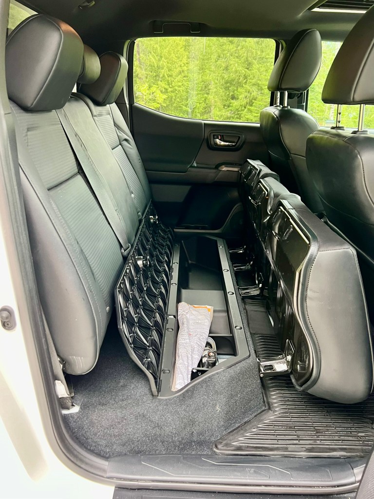
Toyota Tacoma TRD OffRoad 6 ft bed 2021 4X4 DBL King Cab L/B 3.5LV6
Milage: 43,166
Features:
-Super white w LC27 Black Rubber truck bed protector
-TRD Premium Offroad package
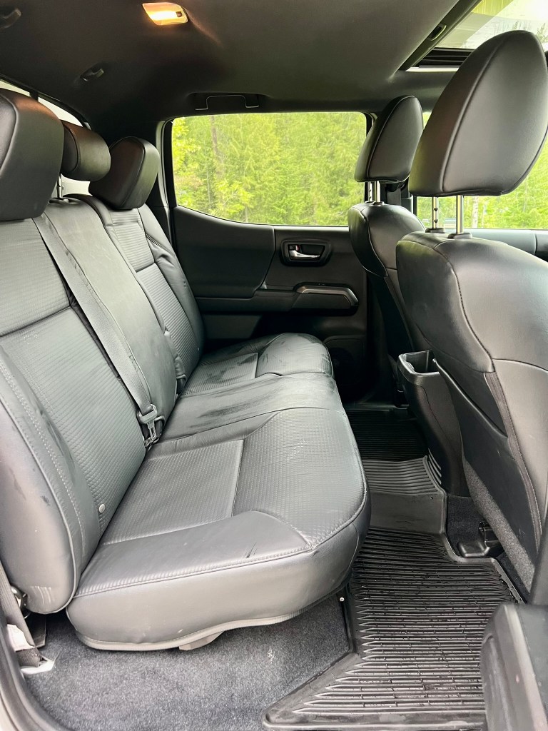
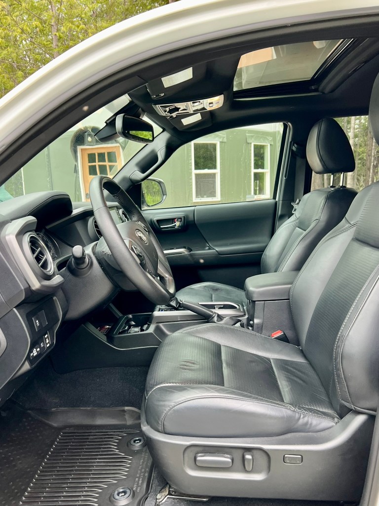
-Technology Package -Leather Interior -N-FAB running boards (sanded and new 3 coast Rustoleum paint)
-Goodyear Airbags
-All weather floor liners/door sill protection
-2022 Falcon WildPeak AT3W Tires LT265 75R 16
-Bed Lights
-Bed outlet
-Mudguards
-Fluid Flow undercarriage sealer