
I have a new respect for great youtubers and bloggers and I will no longer complain or make fun of a vlogger who did not have the most engaging post. It is hard work to have an entertaining post! We have been on the road for nearly 6 months now and my goal when we first started was a video/blog a week. Being on the road, much of this country has dead zones with zero cell service, which makes editing and posting blogs and vlogs on YouTube and WordPress difficult if you are trying to be consistent! After traveling 100-150 miles in a Sprinter Van, setting up camp, cooking, cleaning, hiking, biking, and/or paddle boarding, many times I find myself just wanting to enjoy a beer and the view and not jumping on my computer to write or video edit! I have found myself not posting for several weeks or even getting my computer out, which is not good if you are trying to create a following. You must have consistency with vlog/blog postings every week. I also did not realize how much work it is to create a good video and the frustration of right before compressing your video(that you spent 50 hours editing) that your audio for one part was bad and hard to understand and need to decide do I: redo the video, do a voiceover, just add music or say oh-well and post the bad audio (I’ve done all but redo the full video, which is not good if you are trying to create great quality- sorry to those who would like us to redo the Boldt Review Video!). I have decided I probably won’t get to be the quality level to get great sponsors but hope these will be helpful for your travels, help newbie RVers not to make our same mistakes or be great virtual explorations if you can’t get out to these wonderful places. This week’s post won’t have a video but just photos.

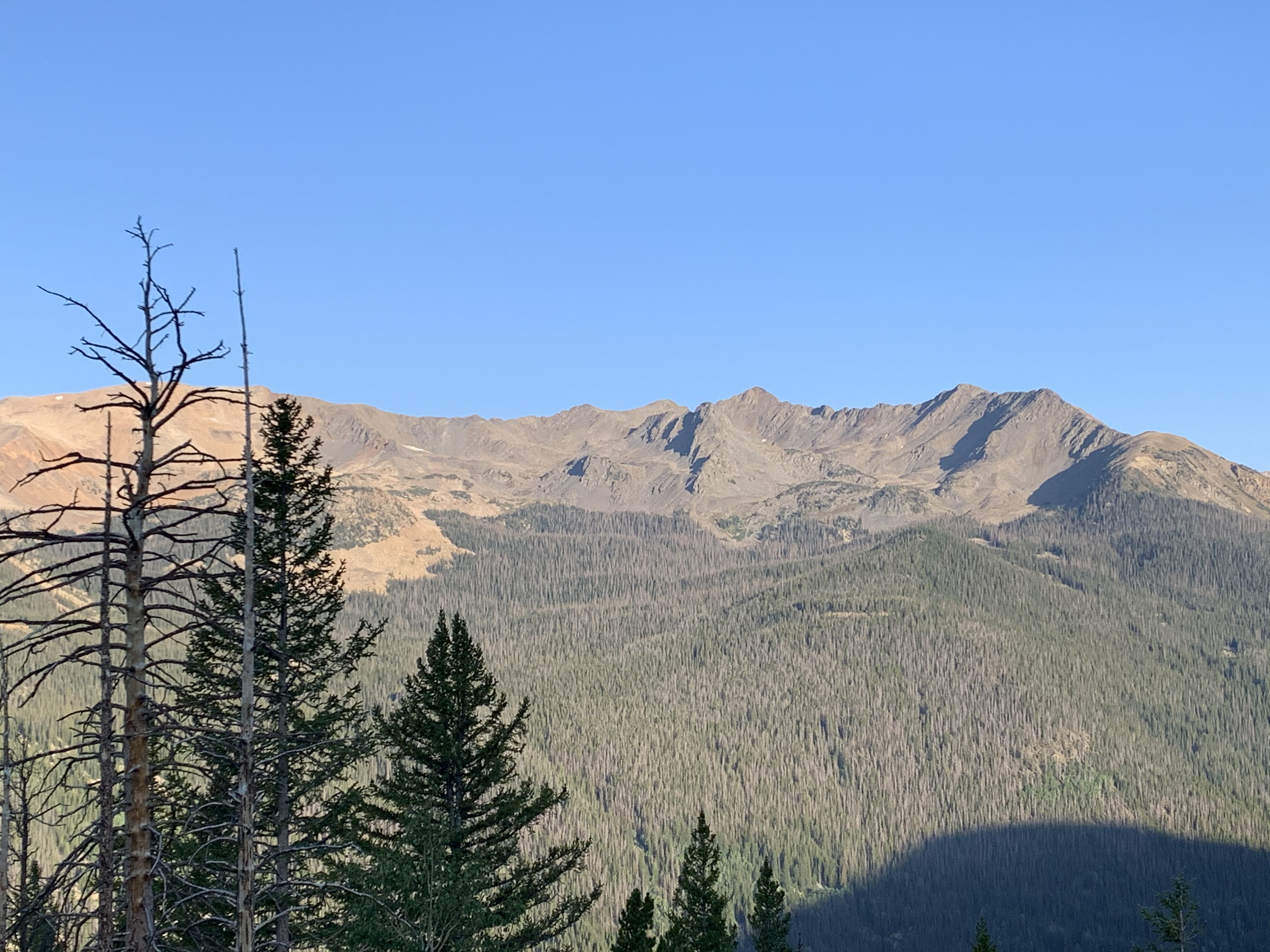


This week I’ll be sharing our adventures at the Rocky Mountain National Park. We were considering skipping this park since it is so close to Denver and we have been trying to avoid huge crowds but I am so glad Greg pushed us to change our minds. Currently, with COVID19 Rocky Mountain requires you to have a timed entry permit or a campground reservation or arrive before the park opens at 6am. This is fabulous and made this one of our favorite places to visit, as there are about 60% less people in the park right now! The only two campgrounds are open (Moraine Park and Glacier Basin) and only half of the campground is open for social distancing requirements. Even if you go on reservation.gov and see no campsites available, I suggest calling the toll-free number (877-833-6777) and sitting on hold for 45 minutes as several people cancel last minute and this is how we got our two-day campsite reservation. We stayed at Glacier Basin in Loop B, if you can get Loop C that is the loop with the amazing views and a chance to see Elk and Moose in the meadow if your neighbors can be quiet and not run their generators.


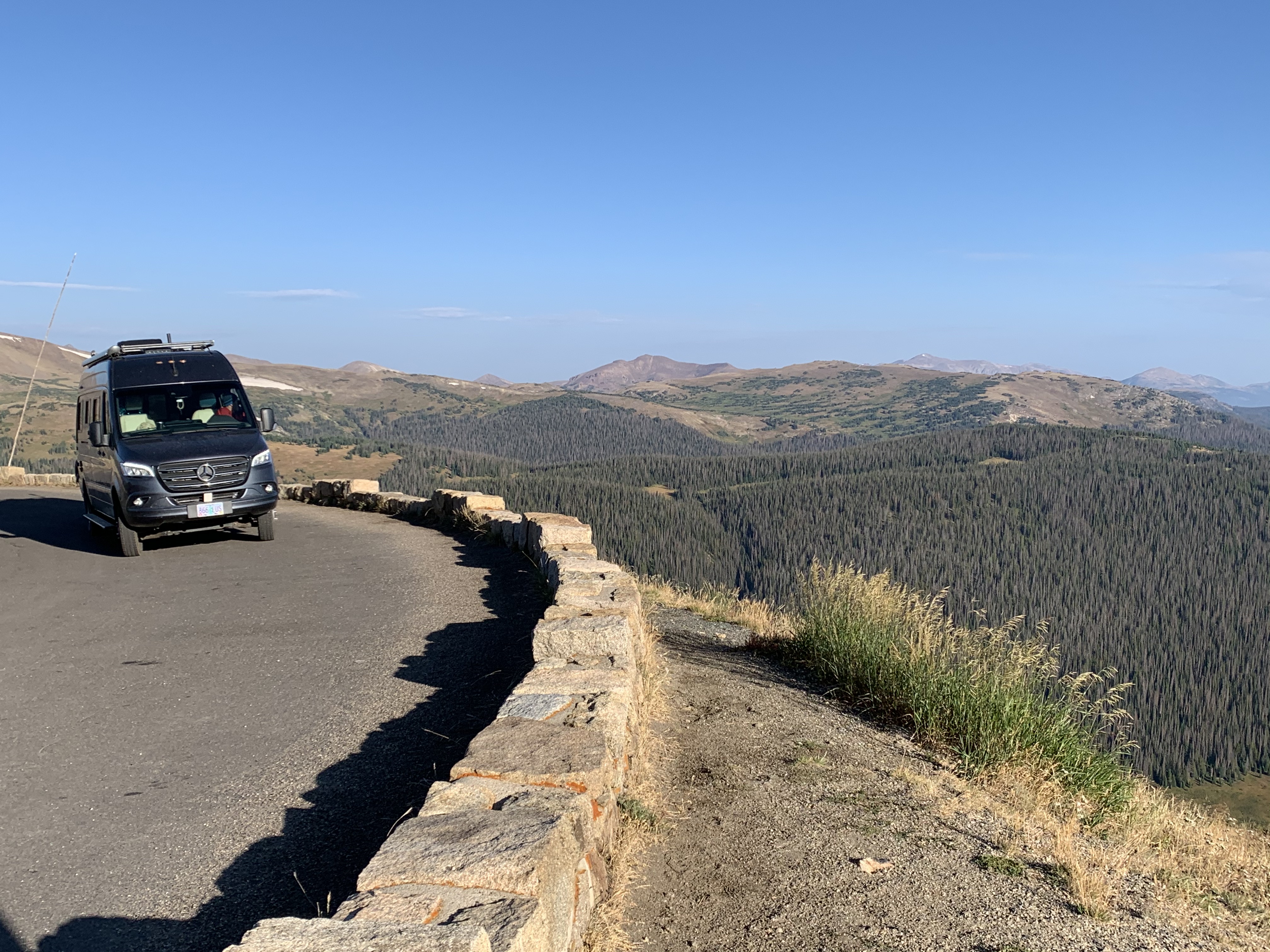
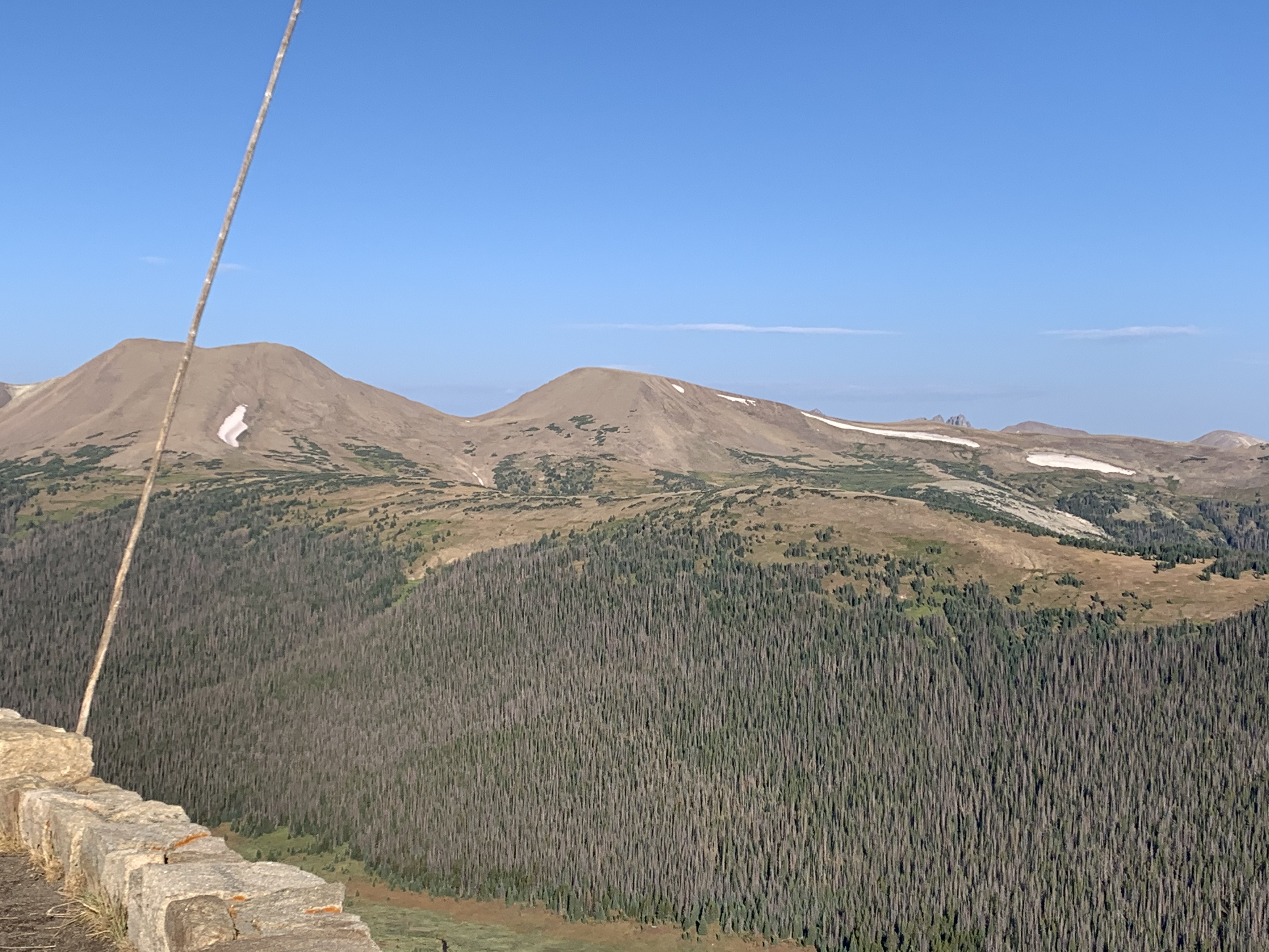
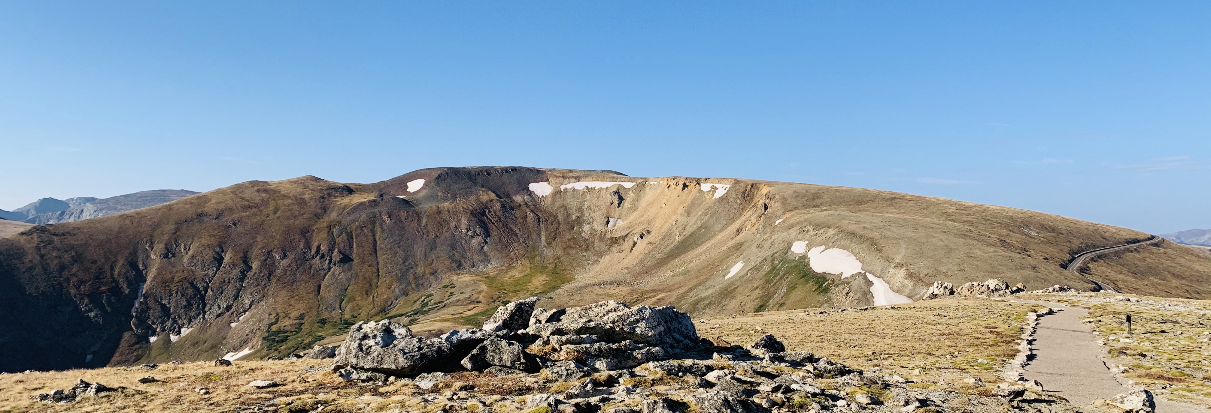
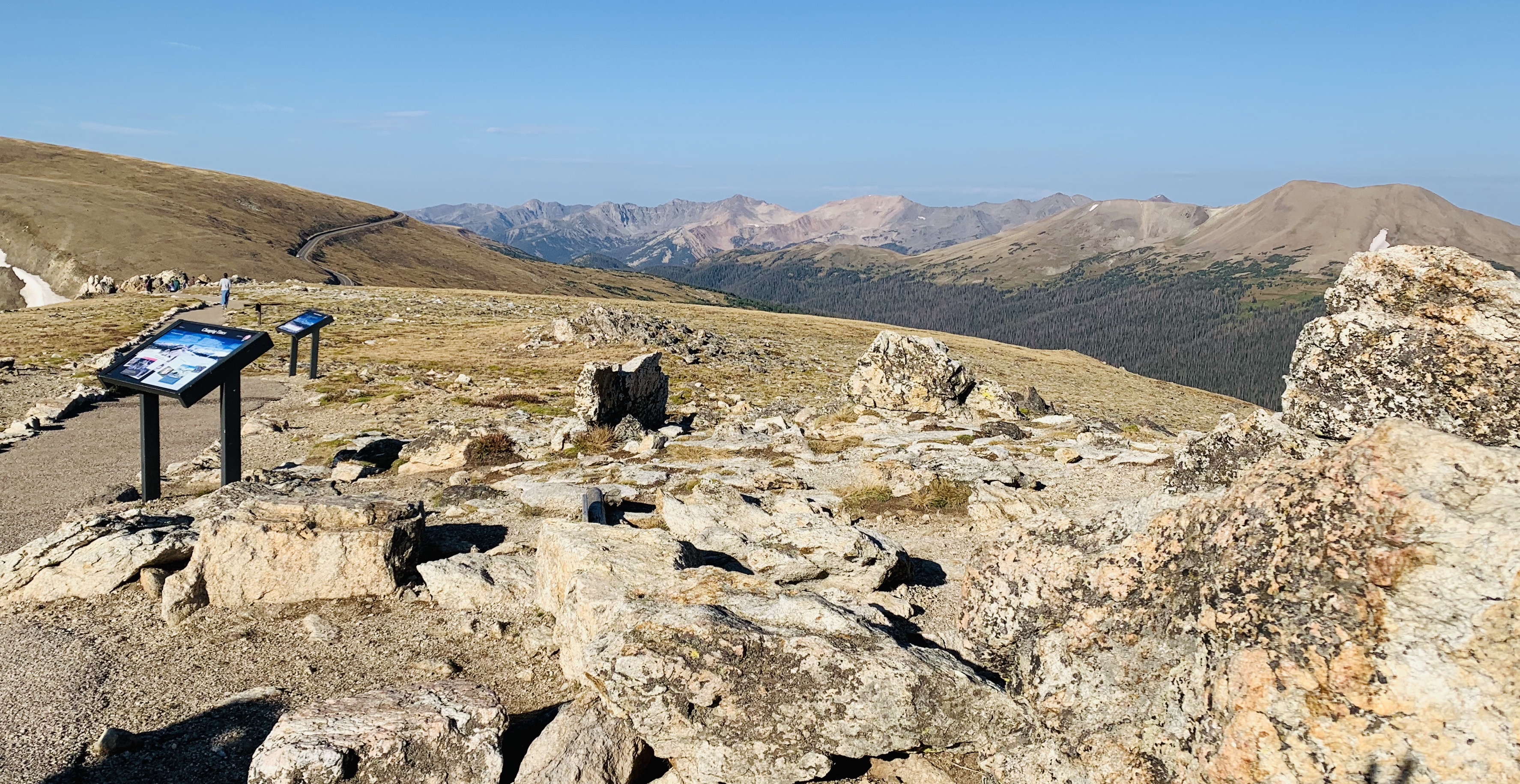
We entered from the westside, which I recommend as only 20% of park attendees come from this entrance, most come from the eastside-Denver Area. We camped the night before at Lake Granby at Stillwater Campground, which is a fun paddle boarding lake. We decided to stay here instead of boondock since a big thunder and windstorm was expected for the late afternoon and we didn’t want to get our van stuck in sand. There were a lot of fisherman and plenty first come first serve campsites next to the lake. We left early the next morning 5am to hit the park to see wildlife. We were able to see moose, elk, prairie falcon, peregrine falcon, marmot, ground squirrels and golden eagles. There was plenty of room to stop at every pullout and interpretive trails and hiking trails. All morning we only saw 3 cars until we got to Deer Ridge Junction when you get to the intersection of 34 and 36 the eastside and westside. We stopped at the EndoValley Picnic Area which is the end of 2 way. We were going to bike the Old Fall River Road which is one way the road is a gravel dirt road and pretty narrow, not something you want to attempt in your camper van unless you are a great backroad 4X4 higher clearance driver. It was already 90 and when seeing how close cars/trucks come by you on the trail we decided to turn back on our bike ride. After stopping at Sheep Lake, looking for our Bighorn Sheep (none were out) we headed to our campground before the big thunderstorm hit again in the late afternoon. This campground also had an RV dump and water fill area, which was great!


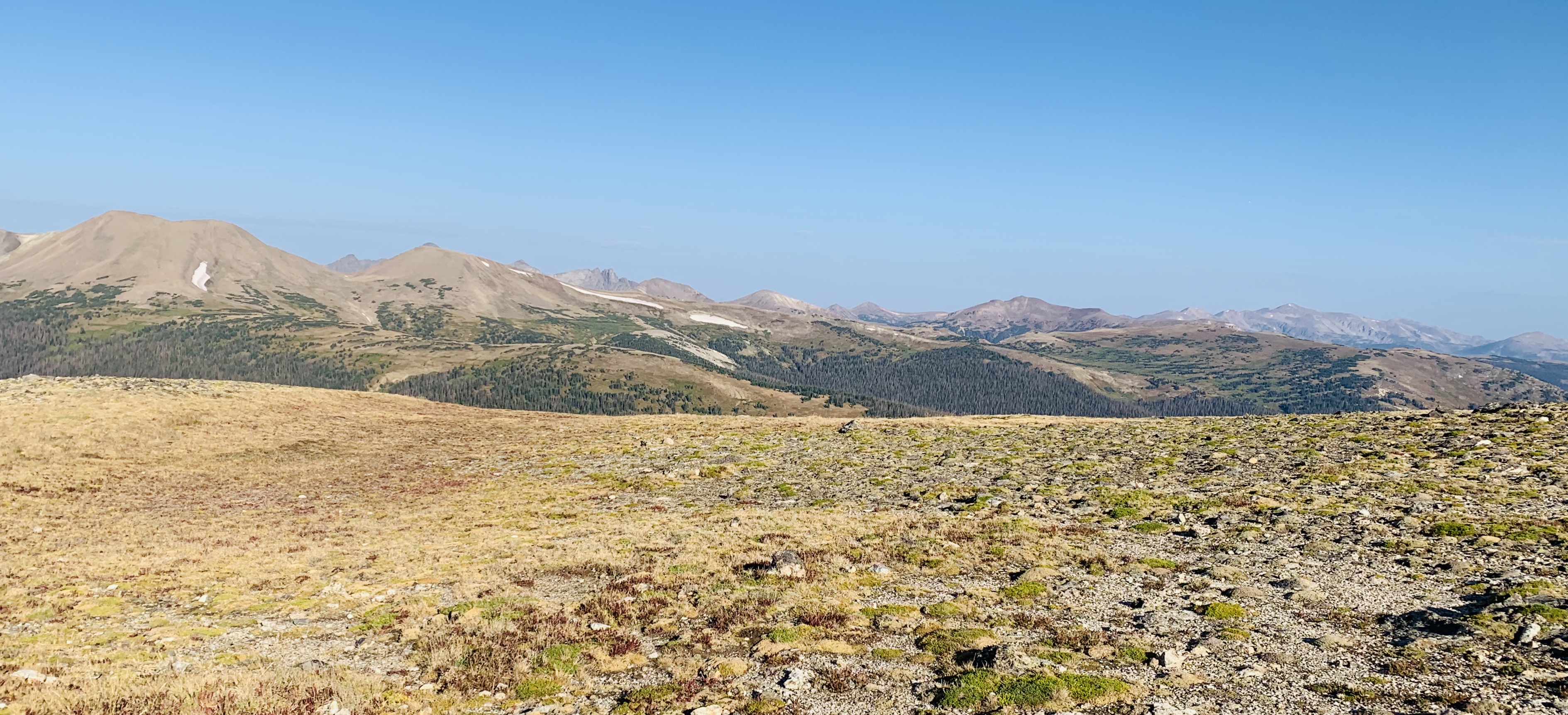
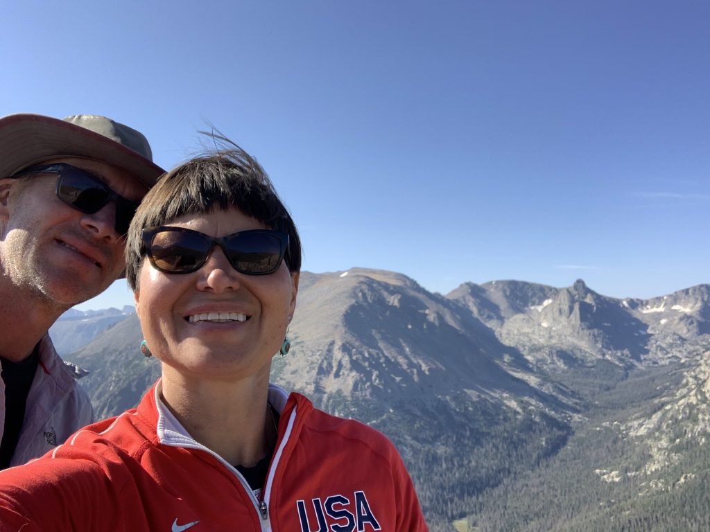
The next morning, we headed out early again at 5:45am as I wanted to hike to Dream Lake to watch the sunrise. Note RVs greater than 21 feet need to park before you get to the Glacier Gorge Trailhead there is a parking lot RVs could fit under 25 feet and a couple pull outs after Bierstadt Lake Trailhead right before Glacier Gorge. Note: There is a sign that says RVs greater than 23 feet should not go beyond the Park and Ride across from Glacier Basin. We did not notice this so when we got to Bear Lake we were asked to leave that our rig was too big (we are 23 feet). Greg went back to the campground and I did the hike by myself and I would take the shuttle back to the campground. There is a free shuttle but it doesn’t start running till 730am. I highly recommend taking the shuttle, remember to bring your mask it is required to get on the bus. I got there just in time to take the trail to see Bear Lake, Nymph Lake, Dream Lake and Emerald Lake and watch the sunrise over Dream Lake. It was beautiful but a lot of traffic! The parking lot was almost full at 6:15am and the Glacier Gorge Trailhead parking lot was already full. As I returned to Bear Lake Parking Lot, I decided to take the Alberta Falls Trail and then return to the Glacier Gorge Trailhead and take the shuttle back to the campground. The campground has water and an RV dump. We then took Highway 7 out of the park and the backroads to North Glenn as we head to Florissant Fossil Bed National Monument. We decided to stay at Cracker Barrel for the night but there were several great boondocking spots along the river on highway 7.
Advice if you go to the park:
- Enter through the Westside, only 20% of visitors come this route
- If camping at Glacier Basin campground stay in Loop C
- Do sunrise hike to Dream Lake
- Use the free shuttle, make sure to bring a mask or you can’t get on!
- Bring your bike/e-bike to travel through the park makes it much mroe enjoyable
 On April 13th, 2020 our one-year expedition to all the National Parks and Monuments got put on pause. As our subscribers know, I finally listened to Greg and sold my business and officially retired in December 2019 and after a year of research we decided to purchase a 2020 Winnebago Boldt BL in January of 2020. We did our shake down trip and drove from Iowa to Oregon via a southern route through Missouri, Kansas, Oklahoma, Texas, New Mexico, Arizona, Nevada, and California. When we got home, we had several fixes for our Winnebago, (video to come soon check out our Boldt Review Video) and headed out on our second trip to see the California Coast and Highway one. Unfortunately, during that trip Bode got a few ticks (it seemed to be a crazy tick season on the California Coast this Spring) and we headed back to do some reorganizing and ensure Bode was tick free before we started our full-time vanlife.


