So a little food for thought… We are a few months in on living the full-time vanlife. When we made this decision to rent our homes and go full-time for a year to visit all our US National Parks, monuments and beautiful outdoor spaces there was not an inkling of the global pandemic. When you no longer have a home to go to, what do you do during a pandemic? You try to be super diligent and responsible citizens.
We try to only use shopping services with curbside pick up at the store such as Walmart’s Grocery App and pick-up groceries (once a week or less). We have the Pacific Pride Commercial Gas cardlock so we don’t go to ‘normal’ gas stations unless we need to fill with DEF (which may not be available at all cardlock locales). We have focused on staying at BLM (Bureau of Land Management) public lands dispersed camping to avoid people and other RVers. When there is a national park or monument or state park that is open we go very early in the morning and avoid other people and look for dispersed campsites or primitive campsites with the minimum people. Once in a while though you must go to a park where there are people so you can dump and refill water, sometimes there are rest stops or gas stations that allow you to do this.
As I watch social media, people are being pretty harsh and disrespectful to RVers and vanlifers. Saying we are irresponsible and making the pandemic worse. We are seeing more and more of our outdoor spaces close, which we understand may be the right thing to do to slow the curve but there are many Americans who do live the RV life full-time who are struggling to find a spot to shelter in place. Many of the RV private places are very expensive and difficult for those who have chosen this life to pay $75 a night for months on end and many have also closed. We are lucky we have a lot of solar and lithium batteries to be able to be off the grid but many can’t live like us. I understand folks being upset about RVers on the road but they must also understand not everyone can hunker down in their homes and stay in one place when they don’t have a home to stay at. We need to have empathy and understanding that people can be responsible adults, do the right thing and that they are not out to be irresponsible and trying to make the pandemic worse but have no other choice because they made this choice of a different lifestyle. I have spoken to friends where they see several people who are living in a home and going to the grocery store daily and come closer than 6 feet on trails and causing more issues than many RVers. So how can we come together and help each other do the right thing when we have people with homes on wheels? Can we stop shaming, lecturing and give more positive advice and understanding? Can we be more supportive of people with different lifestyles? Lets help each other, those who have stationary homes and homes on wheels be able to live and still flatten the curve.
So on to the virtual tour…
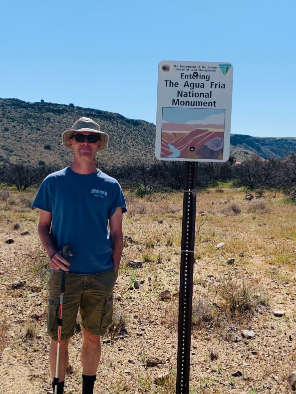
For those of you following us, who have asked us to continue to do virtual tours of our hikes, monuments and places we see for your children’s virtual tour and online school work. Here is our second installment. We were at Aqua Fria National Monument in Arizona. It is 71,000 acres and about 45 miles from Phoenix. Quoted from the BLM webpage, “The monument encompasses two mesas and the canyon of the Agua Fria River. Elevations range from 2,150 feet above sea level along the Agua Fria Canyon to about 4,600 feet in the northern hills. The diversity of vegetative communities, topographic features, and a dormant volcano decorates the landscape with a big rocky, basaltic plateau. This expansive mosaic of semi-desert area, cut by ribbons of valuable riparian forest, offers one of the most significant systems of prehistoric sites in the American Southwest.
In addition to the rich record of human history, the monument contains outstanding biological resources. The area is the home to coyotes, bobcats, antelope, mule deer, javelina, a variety of small mammals and songbirds. Eagles and other raptors may also be seen. Native fish such as the longfin dace, the Gila mountain sucker, the Gila chub, and the speckled dace, exist in the Agua Fria River and its tributaries.”
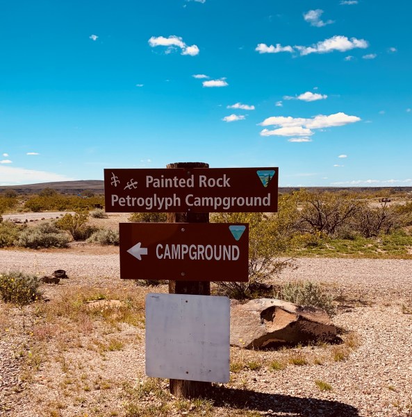
We ended-up being able to disperse camp (boondock) about 800 yards from the Badger Springs Trailhead. The road from the freeway is a pretty rough dirt road, very rutted out, muddy in spots and most suited for a 4×4 vehicle. The Badger Springs Trail is an easy 1.5 mile trail that really follows the Badger Springs Wash, so don’t wear running shoes like us, unless you don’t mind wet shoes and socks. I’d suggest a good pair of hiking boots. The trail isn’t well marked and has a lot of cactus and cheat grass growing over the trail. I would say not very dog friendly once Summer time hits and the cheat grass has dried, tough on their little paws. At the time we hiked it was very green and soft. The trail ends as Badger Springs Wash runs into the Agua Fria River Canyon, with a small waterfall through boulders and at an archaeological spot rich with a few petroglyphs. Here is a link to our new video- enjoy!
Here is our virtual tour on the RGBAdventures YouTube Channel, don’t forget to subscribe to our channel! We are almost to 100 subscribers, help us get over the line. Enjoy!